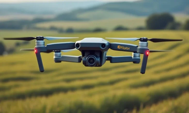
The way we study and protect the natural world is constantly evolving. Environmental research has always relied on observation, data collection, and the ability to monitor changes over time. In the UK, where landscapes vary from rugged coastlines to dense woodlands and rolling farmland, the challenges of gathering accurate information have often slowed progress. Traditional fieldwork is still an essential part of environmental science, but the emergence of drone technology is reshaping what is possible. Drones, also known as unmanned aerial vehicles, are becoming an indispensable tool for researchers, offering a new perspective that combines efficiency, safety, and accuracy.
Expanding the View of the Natural World
One of the greatest advantages drones bring to environmental research is the ability to capture aerial views at a fraction of the cost of manned aircraft. In the past, surveying a forest or monitoring coastal erosion would often require planes, helicopters, or expensive satellite imaging. Drones make it possible to achieve similar results more quickly and at a far lower cost. Researchers can now fly drones over protected habitats, wetlands, or cliffs, gathering detailed images and video that reveal patterns invisible from the ground.
This aerial perspective has allowed for more effective tracking of environmental changes. Whether it is measuring the retreat of glaciers, monitoring riverbank erosion, or identifying areas affected by flooding, drones provide visual data that is both immediate and precise. The accessibility of this technology means smaller research teams, community groups, or universities with limited budgets can conduct surveys that would once have been out of reach.
Monitoring Wildlife with Minimal Disruption
Conservation efforts often depend on monitoring wildlife populations, but traditional methods such as field observation, tagging, or camera traps can be invasive and labour-intensive. Drones have introduced a way of tracking wildlife that reduces disturbance. Quiet, lightweight drones equipped with high-resolution cameras can fly at altitudes that allow observation without causing stress to animals.
In the UK, drones have been used to monitor seabird colonies on remote cliffs and islands, where sending researchers would be both dangerous and disruptive. They have also been deployed in woodland environments to count deer populations or to assess the condition of habitats used by endangered species. The benefit of drones is that they can cover large areas in a relatively short time, providing researchers with accurate counts and behavioural insights without the need for direct contact.
Infrared and thermal imaging technologies enhance this further. At night or in dense habitats, drones can detect animals through heat signatures, giving researchers a clear understanding of movements, nesting habits, or potential threats. This data can then be combined with on-the-ground observations to build a fuller picture of ecosystems.
Tackling the Challenge of Climate Change
Climate change is one of the most pressing environmental issues of our time, and drones are proving vital in tracking its effects. Rising sea levels, changing weather patterns, and increased frequency of storms have made coastal monitoring particularly important. Drones can fly over beaches, dunes, and cliffs to document erosion, sediment movement, and flooding risks. Their ability to provide regular, repeatable flights means researchers can build detailed time-lapse records that show how landscapes are evolving.
In rural parts of the UK, drones are also helping to measure the impact of droughts and heavy rainfall on farmland. Aerial surveys can reveal changes in soil moisture, crop health, and vegetation patterns, which are key indicators of climate stress. By gathering this data, farmers and policymakers can respond more quickly to environmental challenges, improving resilience against the unpredictable effects of climate change.
On a larger scale, drones contribute to global climate studies by collecting data in places that are otherwise hard to reach. For example, monitoring glacial retreat in mountainous regions or documenting deforestation in tropical areas both rely increasingly on drone technology. While satellites continue to provide a broad overview, drones offer the flexibility to capture more localised and detailed information.
Protecting Forests and Green Spaces
Forests are often referred to as the lungs of the planet, and protecting them is crucial for biodiversity and climate stability. Drones are making it easier to assess the health of woodland areas across the UK. By flying over forests, drones can detect signs of disease, pest infestations, or storm damage that might otherwise go unnoticed until it spreads. This early detection gives foresters and conservationists a chance to act quickly, preventing wider damage and protecting habitats.
Tree planting projects have also benefited from drone use. Some organisations now employ drones to map suitable areas for reforestation, measuring soil conditions, slope, and access. In certain parts of the world, drones have even been used to disperse seeds in areas that are difficult to reach by foot. While this is still a developing practice, it highlights the innovative potential of drone technology in expanding conservation efforts.
Urban green spaces are another area where drones have proven useful. Cities across the UK are increasingly reliant on parks, rivers, and green corridors to support both wildlife and public wellbeing. Drones help councils and community groups survey these spaces, measure air quality impacts, and ensure that ecosystems within cities remain healthy and connected.
Advancing Marine and Coastal Studies
The UK is surrounded by water, and its marine ecosystems are among the most diverse in Europe. Studying these environments, however, can be costly and dangerous. Drones have changed this by enabling researchers to monitor coastlines and nearshore waters with greater ease. Flying over tidal zones, estuaries, and rocky shores, drones capture images of habitats that are otherwise difficult to access.
Drones are being used to monitor plastic pollution along beaches, helping researchers identify hotspots where waste accumulates. This data is vital for local councils and environmental groups tackling the problem of marine litter. In addition, drones equipped with sensors can measure water quality, detecting changes in temperature, turbidity, or pollution levels. These insights are particularly valuable in understanding the impact of industrial activity and agricultural runoff on fragile ecosystems.
Coastal erosion, a growing concern in parts of eastern England, is another area where drones are indispensable. They provide detailed mapping that highlights which areas are most at risk, supporting both scientific research and public planning. The ability to track erosion patterns year by year allows communities to plan more effectively for flood defences, managed retreat, or conservation strategies.
Enhancing Data Accuracy and Research Efficiency
Environmental research relies on the accuracy of data. Traditionally, collecting information often required days or weeks of fieldwork, with researchers walking transects, taking manual measurements, and compiling notes. Drones have streamlined this process, providing large volumes of data in a matter of hours. Their ability to capture high-resolution imagery and use technologies such as LiDAR (Light Detection and Ranging) means researchers can now produce detailed 3D models of landscapes, forests, and waterways.
These models not only improve accuracy but also make research more accessible. Information can be shared digitally with teams across the UK or internationally, supporting collaboration and reducing duplication of work. The efficiency of drone-based surveys also allows for more frequent monitoring. Instead of annual reports, researchers can now track environmental changes on a monthly or even weekly basis, leading to better-informed decisions.
The Human Element in Drone Research
While drones provide remarkable opportunities, they are not a replacement for human expertise. Researchers must still interpret the data, understand the context, and apply ecological knowledge to draw meaningful conclusions. Training is essential to ensure drones are used responsibly and effectively. Operators must be licensed, follow Civil Aviation Authority rules, and respect both privacy and wildlife protection laws.
There are also ethical considerations when using drones in environmental research. Even though they are less invasive than many traditional methods, drones can still cause disturbance if not used carefully. Maintaining a respectful distance from wildlife and adhering to guidelines ensures that the technology benefits conservation without introducing new risks.
In the UK, universities and research organisations are increasingly offering training programmes that combine drone piloting skills with environmental science. This blending of disciplines reflects the growing role drones play in modern research. By equipping the next generation of scientists with these skills, the country is preparing for a future where technology and conservation work hand in hand.
Looking Ahead to the Future of Drones in Environmental Research
As drone technology continues to evolve, its applications in environmental research will only expand. Advances in battery life, camera resolution, and AI-driven data analysis are making drones more capable and more affordable. The prospect of swarms of drones working together to map large areas or conduct simultaneous surveys could transform the scale at which research is carried out.
For the UK, with its diverse landscapes and pressing environmental challenges, drones are already proving to be a valuable ally. From monitoring wildlife to tracking coastal erosion and supporting reforestation, the technology is opening doors to insights that were previously beyond reach. As environmental pressures grow, the ability to respond quickly and effectively will depend on tools like drones, which offer both precision and flexibility.